Drivers new to the area can run tours confidently. The system guides them reliably and helps you stay operational when staffing is tight.
References
Bavaria, GER
Bavaria, GER
Baden-Wurtemberg, GER
Baden-Wurtemberg, GER
Rhineland-Palatinate, GER
Rhineland-Palatinate, GER
North Rhine-Westphalia, GER
North Rhine-Westphalia, GER
Hesse, GER
Hesse, GER
Saarland, GER
Saarland, GER
Location factors
Mountain regions
Seasonal access and weather constraints matter. Planning accounts for conditions and supports advance emptying before winter closures.
Tourist areas
Strong seasonal peaks and short-term occupancy spikes. Forecasts adapt to holidays and demand patterns.
Larger cities
Narrow time windows, congestion, and access rules. Routes include time slots, traffic patterns, and restrictions by default.
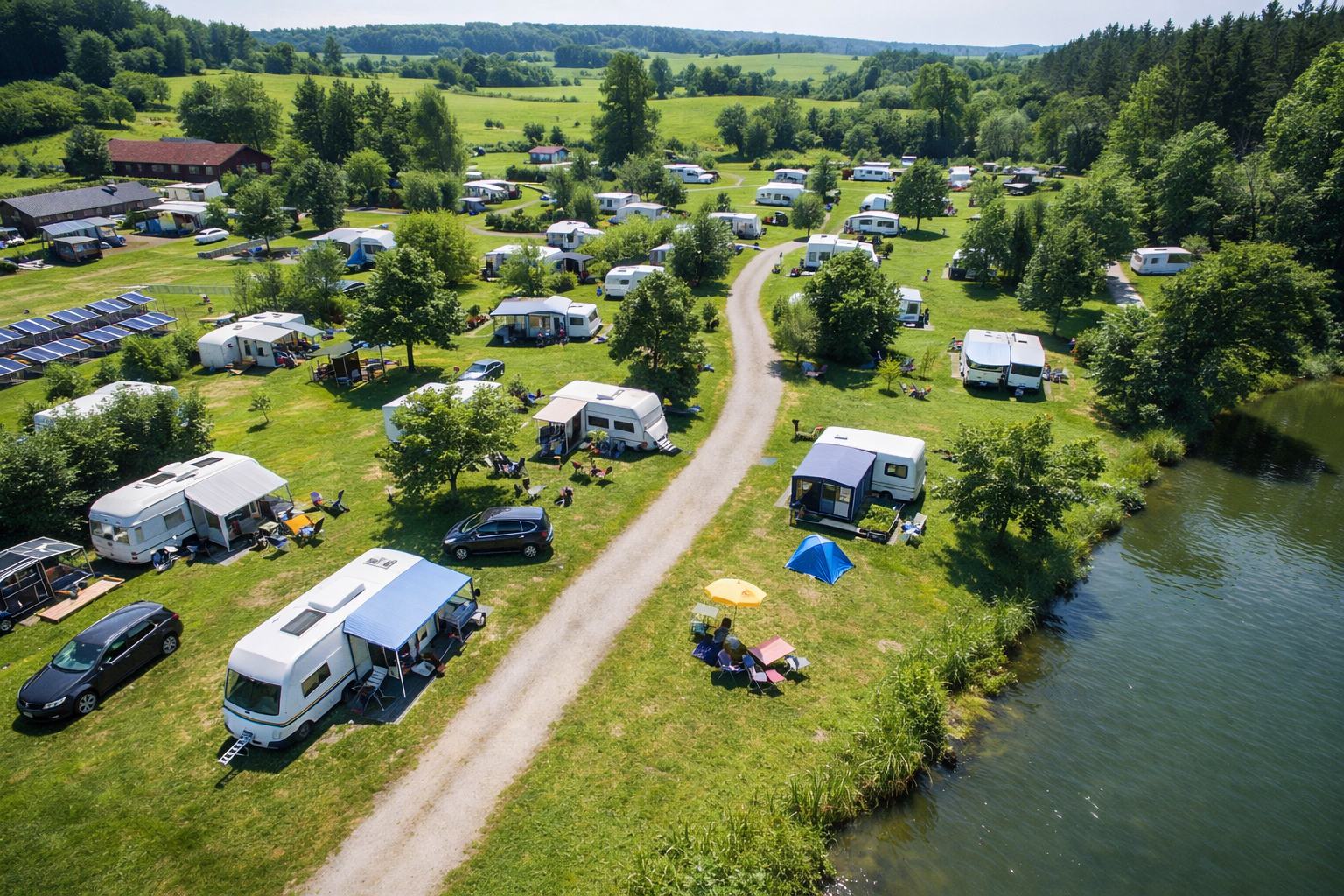
Campsites
Highly fluctuating fill levels and unusual peak times. The system detects patterns early and plans flexibly instead of following fixed cycles.
Areas with many bridges
Route logic is shaped by weight limits and clearance heights. Planning reliably respects these infrastructure constraints.
Medium-sized cities
Urban centers meet rural outskirts. Mixed densities and limited resources require flexible routing that stays practical in daily operations.
Countryside
Long distances make every trip expensive. The system helps ensure each trip is worthwhile, collecting what is needed without unnecessary emptying.
Areas with dense forest cover
Limited connectivity and complex access roads. The system remains reliable even when infrastructure is limited.
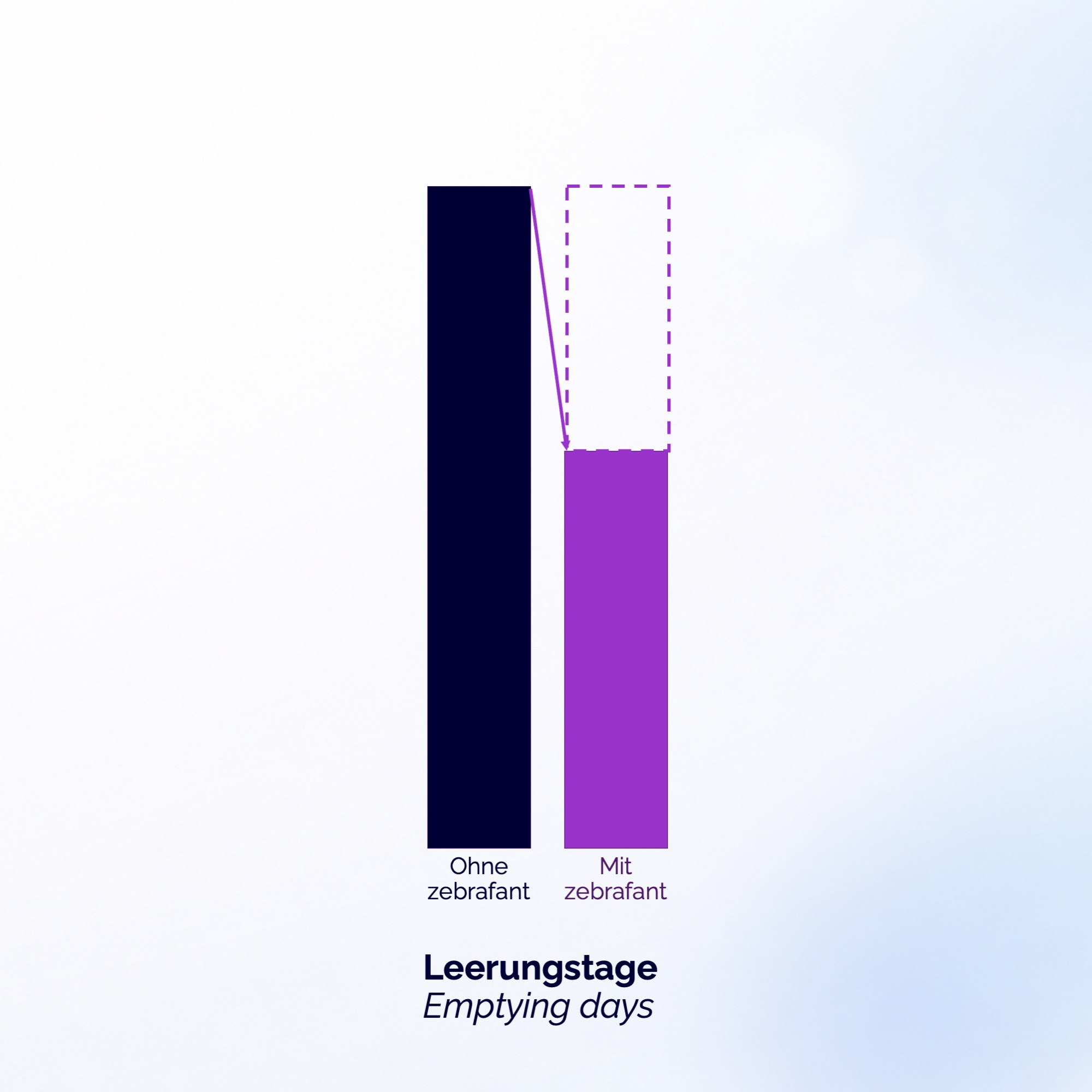
Impact in numbers
30-40%
fewer collection days
90%
fewer spilled containers
40-50%
CO₂ reduction
500k+
scanned waste bin fill-levels
6
deployed across 6 German states
The new industry standard
1. Free ROI & fit check
Is zebrafant a good fit for you?
We will assess together whether zebrafant is suitable for your collection. We assess region, container types, staffing situation, constraints, and realistic savings potential. Free and non-binding.
2. Data onboarding
Real data instead of gut feeling
Your drivers record fill levels during normal tours. No sensors, no extra trips, and no additional organizational effort required. This provides a clear picture of filling behaviour in your area.
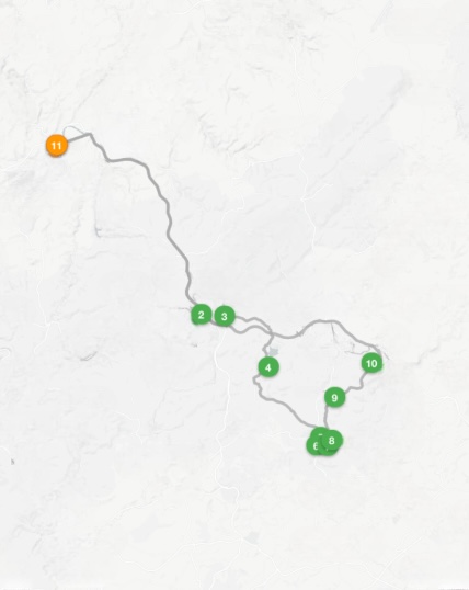
3. Pilot routes + weekly tuning
Smooth transition to the new standard
Once we understand fill behavior, we roll out optimized route planning step-by-step. Weekly tuning ensures immediate relief rather than disruption, even with tight staffing.
4. Scale + continuous improvement
Long-term impact, not a short test
After 3 to 6 months, we unlock additional potential through improved forecasting, container placement optimization, and route refinement. This turns collection into a stable, data-driven standard.
Switch to smart waste disposal
Data instead of gut feeling: fully automated planning.


.jpg)